Aerial Photo Interpretation
DBRC can map and interpret habitats from aerial photos using QGIS/Mapinfo GIS
We are licensed through Devon County Council and Natural England to use 1998, 2003, 2006/7, 2010 and 2015 aerial photos for Devon as well as having our own licence to use the Bluesky 2017 aerial photo dataset.
Aerial photo interpretation can be used to gather information over a large project area, however the resolution of the data gathered will be lower than an on the ground survey. It also can act as a good first filter in longer term projects. If you believe that API may be suitable for your project, you can contact us for further information.
Examples of some of our previous projects include:
- Devon Wildlife Trust – Parish Audit Maps
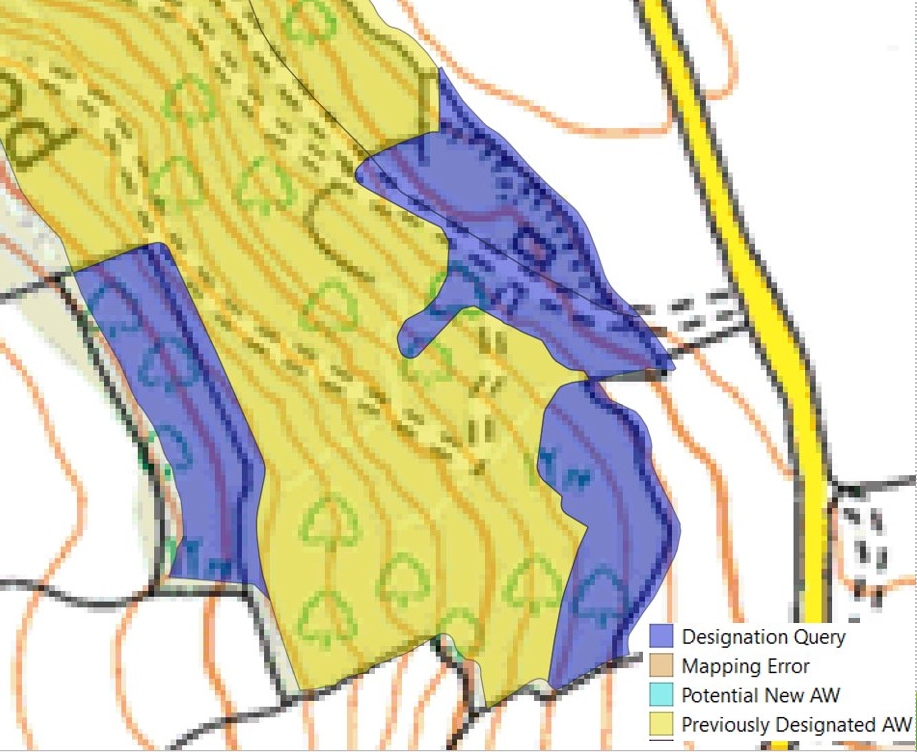
- Devon Ancient Woodland Inventory review – Reviewing boundary changes in existing ancient woodland between historical maps and aerial photos to modern aerial photos
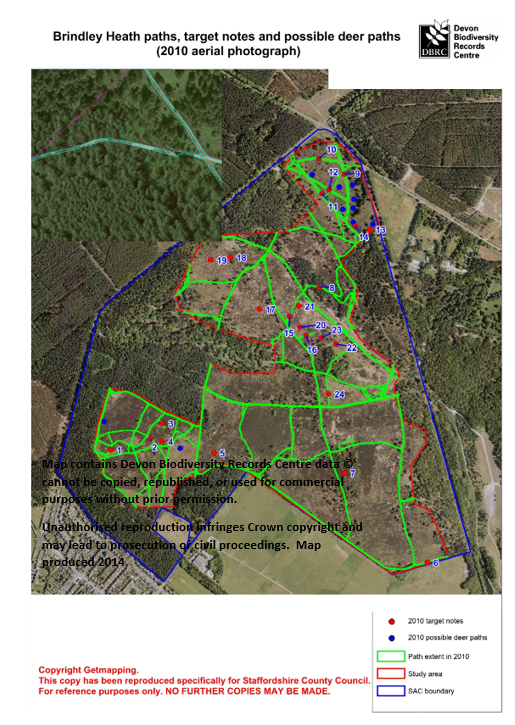
- Cannock Chase SAC – Footpath Extent Assessment Project – Cannock Chase SAC
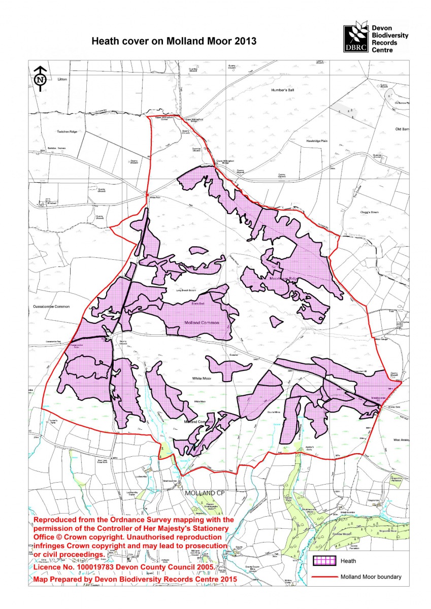
- Molland moor 2013 – mapping changes in heathland coverage using aerial datasets from 1990 and 2013
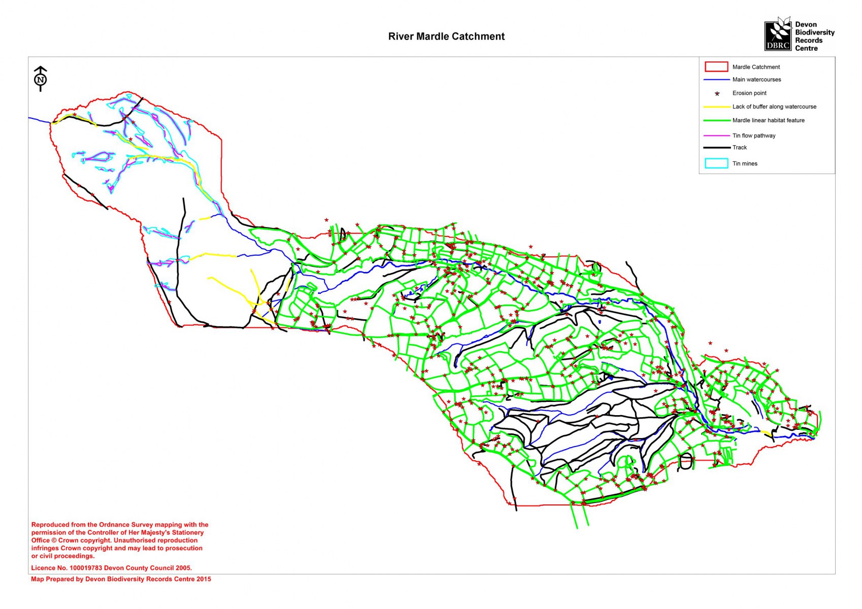
- River Mardle Land Use mapping 2015 – large area phase 1 habitat mapping and identification of potential erosion points


